Geologists rely heavily on technology because it enables the collection, analysis, and interpretation of data about the Earth and its processes. The modern digital technologies for geologists include:
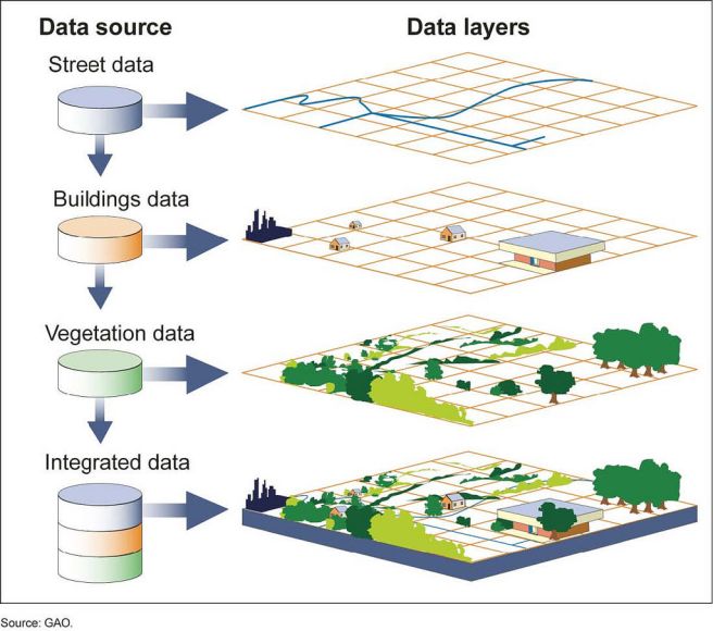
- Geographic Information Systems (GIS): GIS is a digital tool that allows geologists to store, analyze, and visualize data related to geography, including geospatial data such as maps, satellite imagery, and elevation data. GIS allows geologists to create and analyze maps and spatial data to understand patterns and relationships on the Earth’s surface.
- Remote Sensing: Remote sensing is the use of sensors on satellites or aircraft to collect data about the Earth’s surface. Remote sensing allows geologists to collect data from large areas quickly and efficiently, and it can be used to study geology, geomorphology, and other Earth science disciplines.
- 3D Modeling: 3D modeling is a digital tool that allows geologists to create and visualize three-dimensional representations of the Earth’s surface and subsurface. 3D modeling can be used to understand geology, geomorphology, and other Earth science disciplines, and it can be used to help visualize and understand the relationships between different geological features.

- Digital Field Mapping: Digital field mapping is the use of digital tools, such as tablets or smartphones, to collect and analyze field data. Digital field mapping allows geologists to collect and analyze data in real time, reducing the need for paper maps and other manual methods.
- Geospatial Data Management: Geospatial data management is the process of organizing and storing geospatial data in a way that allows for efficient access and analysis. This can include the use of databases and other digital tools to store and manage geospatial data.
- Data Visualization: Data visualization is the use of graphical techniques to represent data and patterns in a visual format. Geologists can use data visualization tools to help understand and interpret data, and to communicate their findings to others.
- Machine Learning: Machine learning is a type of artificial intelligence that allows computers to learn and improve their performance without being explicitly programmed. Geologists can use machine learning to analyze and interpret large amounts of data and to identify patterns and trends that may not be apparent to humans.
- Virtual Reality: Virtual reality (VR) is a digital tool that allows users to experience immersive, computer-generated environments. Geologists can use VR to visualize and analyze geological data and to better understand the relationships between different geological features.
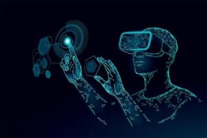
Figure 3 Virtual Reality Applications
- Geostatistics: Geostatistics is a branch of statistics that focuses on the analysis of spatial data. Geologists can use geostatistical techniques to analyze and interpret geological data and to understand the relationships between different geological features.
- Cloud Computing: Cloud computing is the use of remote servers to store, process, and access data and applications. Geologists can use cloud computing to store and access large amounts of data, and to run complex analyses and simulations.

Figure 4: Cloud Computing for geologists
- Geophysical Techniques: Geologists use geophysical techniques, such as seismic imaging and gravimetry, to study the Earth’s subsurface. These techniques involve the use of specialized instruments to measure and analyze the physical properties of the Earth’s subsurface, such as density, magnetism, and elasticity.
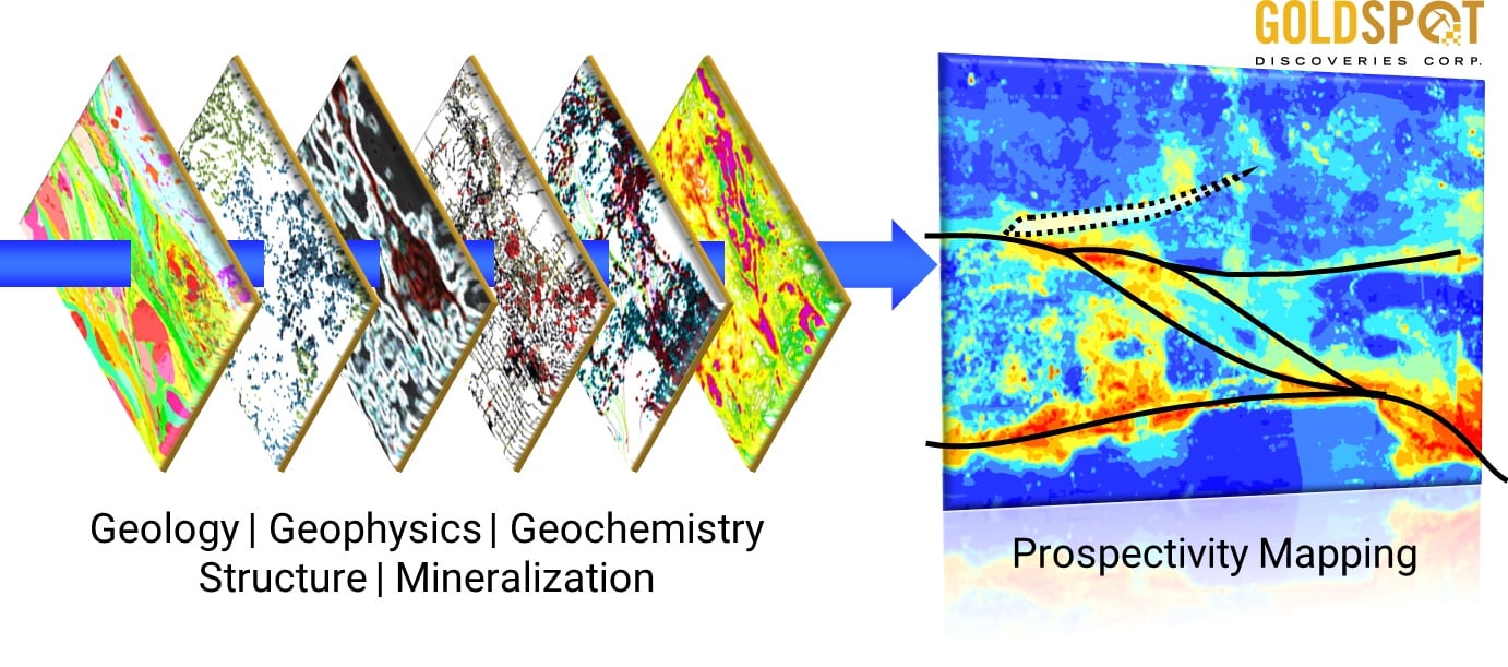
- Geochemical Techniques: Geologists use geochemical techniques, such as spectroscopy and isotope analysis, to study the chemical composition of rocks and minerals. These techniques involve the use of specialized instruments and techniques to measure the chemical makeup of rocks and minerals and to understand the processes that led to their formation.
These modern digital technologies for geologists depend on the use of leading geological software with advance capabilities for data processing, analysis and visualization.