
The Pacific Ocean is entering a phase that climate scientists are watching with unusual intensity. Super El Niño 2026 is not simply another seasonal weather story: it is a developing ocean-atmosphere disturbance capable of redistributing heat, moisture, and atmospheric energy across large parts of the planet.
As of September 2026, NOAA reports that El Niño is strengthening rapidly, with sea-surface temperature anomalies exceeding +3.0°C in parts of the eastern equatorial Pacific and a greater than 90% chance of a very strong event during the Northern Hemisphere autumn and winter. NOAA also assigns a 75% probability that October–December 2026 will reach a historic strength threshold of +2.5°C or greater on its Relative Oceanic Niño Index, exceeding previous events in the post-1950 record.
The World Meteorological Organization is reporting a similar trajectory. Its September 2026 seasonal update projects a Niño-3.4 sea-surface temperature anomaly of approximately +3.6°C during September–November, with the intensification expected to peak around November–December. WMO also places the probability of El Niño persisting through February 2027 at nearly 100%.
That does not mean every region will experience catastrophic weather. El Niño changes probabilities; it does not dictate a single global outcome. The scientific question is therefore not whether every country will be hit by an extreme event, but where the altered circulation is likely to increase the odds of flooding, drought, heat, wildfire, severe storms or unusual winter conditions.
And that is where Super El Niño 2026 becomes more than an oceanographic phenomenon. It becomes a risk-management problem.
What Exactly Is Super El Niño 2026?
El Niño is the warm phase of the El Niño–Southern Oscillation (ENSO), a coupled ocean-atmosphere system centered in the tropical Pacific.
Under normal conditions, easterly trade winds push warm surface water toward the western Pacific. During El Niño, those winds weaken and the distribution of warm water changes. Warmer-than-normal sea-surface temperatures expand across the central and eastern equatorial Pacific, altering evaporation, convection and atmospheric pressure.
Those changes then propagate through the atmosphere.
Rainfall shifts.
Jet streams move.
Storm tracks reorganize.
Temperature patterns change.
The consequences can extend thousands of kilometres beyond the tropical Pacific.
As of September 2026, NOAA reports that El Niño is strengthening rapidly, with sea-surface temperature anomalies exceeding +3.0°C in parts of the eastern equatorial Pacific and a greater than 90% chance of a very strong event during the Northern Hemisphere autumn and winter.
NOAA’s current observations show that the 2026 event is already unusually strong. The August Niño-3.4 anomaly was +1.8°C, while Niño-3 and Niño-1+2 reached +2.5°C and +3.4°C respectively. Beneath the surface, extensive areas of the equatorial Pacific were more than 10°C warmer than average at depth, providing substantial oceanic heat available to interact with the atmosphere.
This is the physical foundation of Super El Niño 2026.
The atmosphere is not responding to one warm patch of ocean. It is responding to a large-scale reorganization of the tropical Pacific heat engine.
Why +2.5°C Matters
The phrase Super El Niño 2026 has gained attention because the event is approaching a level associated with the strongest El Niño episodes in the historical record.
But the number requires context.
The +2.5°C threshold does not mean that the entire Pacific Ocean is 2.5°C warmer than normal. It refers to a specific ENSO index and averaging methodology used to characterize the magnitude of the event.
NOAA’s September outlook gives a 75% probability that the October–December 2026 seasonal RONI value will reach at least +2.5°C—a level NOAA describes as potentially historic relative to events since 1950.
This distinction matters because scientific communication should separate ocean temperature anomalies, ENSO indices, and actual impacts.
A +3°C anomaly in one part of the Pacific does not translate mechanically into +3°C air temperatures elsewhere.
Instead, the warmer ocean modifies atmospheric circulation, and that circulation redistributes heat and moisture.
That is why Super El Niño 2026 should be understood as a global climate amplifier rather than a single weather event.
Super El Niño 2026 and the Global Redistribution of Rainfall
One of the defining characteristics of Super El Niño 2026 will be its influence on precipitation.
NOAA’s historical El Niño composites show increased December–February rainfall in areas including coastal Ecuador, northwestern Peru, southern Brazil, central Argentina and equatorial eastern Africa. At the same time, drier-than-normal conditions are commonly associated with northern South America, Central America, Indonesia and southern Africa during the same season.
This is why one of the biggest misconceptions about El Niño is the idea that it simply means “more rain.”
It does not.
El Niño redistributes atmospheric moisture.
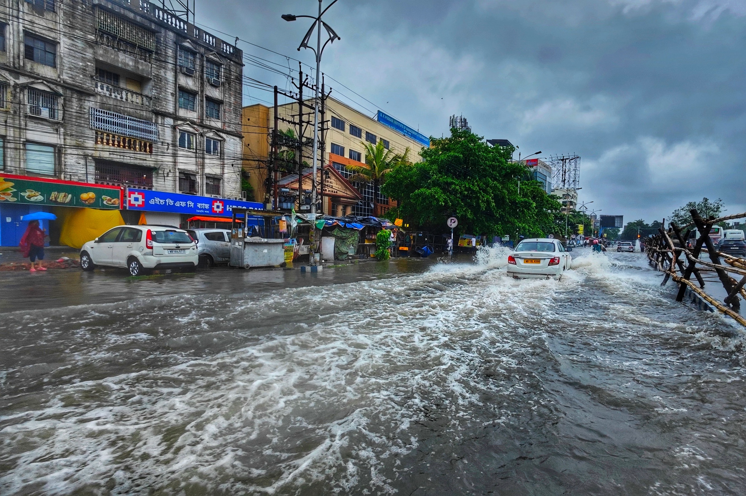
One region may receive rainfall far beyond its infrastructure’s capacity to absorb it, while another experiences a prolonged precipitation deficit.
The resulting hazards can therefore appear contradictory:
flooding in one region and drought in another.
That spatial contrast is fundamental to understanding Super El Niño 2026.
East Africa: Why Heavy Rainfall Deserves Serious Attention
East Africa is one of the regions where the El Niño signal can become particularly consequential.
NOAA’s historical El Niño pattern identifies equatorial eastern Africa as one of the regions that tends to experience wetter-than-normal conditions during the December–February period.
But rainfall totals alone do not determine flood risk.
The more important variables are:
- rainfall intensity;
- rainfall duration;
- antecedent soil moisture;
- catchment condition;
- river capacity;
- drainage infrastructure;
- urban expansion;
- wetland encroachment;
- reservoir storage;
- and the location of communities and infrastructure relative to floodplains.
A degraded watershed can transform intense rainfall into rapid surface runoff.
A heavily urbanized catchment can do the same because concrete, asphalt and compacted soils reduce infiltration.
Consequently, Super El Niño 2026 may expose weaknesses that already exist within drainage systems rather than creating those vulnerabilities from nothing.
This distinction is crucial.
The climate system supplies the hazard.
Land-use decisions determine how much of that hazard becomes a disaster.
Southern Africa and Indonesia: The Other Side of the El Niño Pattern
The hydrological signature of Super El Niño 2026 is not uniformly wet.
Historically, El Niño is associated with increased drought risk across parts of southern Africa during the Southern Hemisphere summer. NOAA also identifies northern Australia and Indonesia among areas where drier-than-normal conditions commonly occur during El Niño.
The consequences can extend beyond rainfall statistics.
Persistent dryness can increase:
soil-moisture deficits → vegetation stress → agricultural losses → wildfire risk → water-supply pressure → food-security impacts.
Indonesia is already providing an important real-world indicator. Carbon Brief reported in September 2026 that Indonesian fires had produced approximately 76 million tonnes of carbon by 7 September, putting 2026 on a trajectory comparable with the country’s severe 2015 fire season.
That does not mean every fire in Indonesia is caused by El Niño. Fire regimes are influenced by land management, peat drainage, human ignition and weather conditions.
But a warmer and drier background can make landscapes more conducive to fire spread.
This is precisely why Super El Niño 2026 needs to be analyzed as a risk multiplier rather than a single causal mechanism.
What Super El Niño 2026 Could Mean for Winter Weather
For people in the Northern Hemisphere, the immediate question is obvious:
What will winter 2026–27 actually look like?
The answer depends heavily on geography.
El Niño modifies the position and strength of the jet stream and influences where storms preferentially develop and travel. NOAA’s historical composites show recognizable winter patterns across North America, but those patterns are probabilistic rather than deterministic.
This means a winter weather outlook 2026 should never be interpreted as a promise that every city will experience the same conditions.
Some locations may experience increased precipitation.
Others may experience reduced snowfall.
Some areas may be warmer than normal.
Others may experience substantial cold outbreaks despite the broader El Niño signal.
The atmosphere remains a chaotic system.
A strong ENSO event changes the background probabilities; it does not eliminate short-term weather variability.
That distinction is particularly important when discussing Super El Niño 2026.
Could Super El Niño 2026 Produce an ARkStorm-Type Disaster?
This is where scientific imagination must be separated from scientific prediction.
The ARkStorm is not a forecast for 2026.
It is a scientifically plausible disaster scenario developed by the U.S. Geological Survey and partner institutions to examine what could happen if California experienced an extreme sequence of atmospheric-river storms comparable to the historical 1861–62 events.
The scenario is important because it demonstrates how multiple hazards can compound.
A prolonged atmospheric-river sequence could produce:
- extreme precipitation;
- widespread flooding;
- landslides;
- infrastructure failures;
- power disruption;
- transportation interruptions;
- contamination;
- business interruption;
- and large-scale evacuation.
The USGS describes ARkStorm as a hypothetical but scientifically realistic planning scenario, not a prediction.
So should Super El Niño 2026 be described as an ARkStorm?
No.
That would be scientifically unjustified.
Could a strong El Niño contribute to atmospheric conditions that alter the probability of extreme precipitation in parts of the western United States?
Yes.
That is the scientifically defensible question.
The distinction is more than semantics. It separates climate-risk analysis from sensational forecasting.
The Scientific Anxiety Is Not About One Storm
The deeper concern surrounding Super El Niño 2026 is not necessarily a single “megastorm.”
It is the possibility of compound extremes.
Imagine a winter in which:
- a region receives unusually intense rainfall;
- soils are already saturated;
- rivers are elevated;
- reservoirs have limited storage capacity;
- an atmospheric river arrives;
- landslides block transportation routes;
- electricity infrastructure is damaged;
- telecommunications become unreliable.
The resulting disaster is not simply “heavy rain.”
These interconnected hazards are part of a broader challenge of climate risks reshaping the future of African cities, where infrastructure, drainage, water systems, and emergency-response capacity increasingly have to be designed around multiple climate hazards.
It is a cascading infrastructure failure.
This is how modern climate risk should increasingly be analyzed.
Not hazard by hazard.
System by system.
How to Prepare Your Home for Super El Niño 2026
Preparedness should begin before extreme weather appears in the forecast.
The first step is to determine whether your property sits within or near a flood-prone area, drainage corridor, river floodplain or low-lying zone.
Then inspect the physical vulnerability of the property.
Start with the building envelope
Check:
- roof condition;
- gutters;
- downspouts;
- drainage channels;
- doors and windows;
- retaining walls;
- basement or lower-level entrances;
- electrical equipment;
- external structures;
- and trees that could fall during high winds.
The U.S. National Weather Service recommends securing loose outdoor objects, closing windows and doors, trimming branches near homes and identifying safe areas before severe weather arrives.
For properties in flood-prone areas, consider whether valuable equipment can be elevated above expected flood levels.
Move important documents into waterproof storage.
Do not wait until water is entering the building.
Review Your Flood Insurance Before the Forecast Becomes a Crisis
Flood insurance deserves special attention because purchasing coverage immediately before a flood does not necessarily provide immediate protection.
Under the U.S. National Flood Insurance Program, new policies and endorsements generally have a 30-day waiting period, although specific exceptions apply.
The broader lesson applies even outside the United States:
Review insurance before the hazard becomes imminent.
Check:
- whether flood damage is covered;
- whether contents are covered;
- whether temporary accommodation is covered;
- the policy limits;
- deductibles;
- exclusions;
- waiting periods;
- and whether the policy reflects the current value of the property.
Insurance is not a substitute for flood resilience.
It is one layer within a broader risk-management system.
Build a Real Emergency Kit
A sophisticated climate-risk article should not end with “buy bottled water.”
A functional emergency kit should support you through the first hours or days of disruption.
Consider:
- drinking water;
- shelf-stable food;
- first-aid supplies;
- essential medication;
- flashlights;
- spare batteries;
- power banks;
- battery or hand-crank radio;
- phone chargers;
- hygiene supplies;
- copies of important documents;
- basic tools;
- emergency cash;
- waterproof storage;
- and supplies for children, older adults or pets where relevant.
The U.S. government’s Ready.gov preparedness guidance similarly emphasizes emergency kits, communication plans, emergency alerts and alternative phone-charging methods during power outages.
Super El Niño 2026 and Localized Power Grid Disruptions
Extreme weather does not need to destroy an entire power grid to cause serious disruption.
A single damaged substation, flooded electrical room, fallen transmission line or inaccessible maintenance route can create localized outages.
That means preparedness should include energy redundancy.
Charge power banks before major storms.
Protect sensitive electronics from electrical surges.
Keep essential devices operational.
Know where the main electrical shutoff is located if flooding threatens the property.
And if you use a generator, operate it outdoors and away from enclosed spaces because of carbon-monoxide risk. The National Weather Service specifically warns against using portable generators inside homes or garages after storms.
For households dependent on electrically powered medical equipment, power resilience becomes a life-safety issue rather than merely a convenience.
Super El Niño 2026 Is Also a 2027 Temperature Story
One of the most scientifically interesting aspects of Super El Niño 2026 may occur after the calendar year ends.
There is often a lag between the peak of tropical Pacific warming and the maximum response in global mean surface temperature.
Carbon Brief’s July 2026 analysis estimated that the developing event could have its largest global temperature influence in 2027, projecting a central estimate around 1.71°C above the 1850–1900 baseline, although the publication emphasizes uncertainty and differences among datasets.
This is the scientific basis behind searches for an El Niño 2027 temperature record.
But “record” should not be treated as a certainty.
Carbon Brief’s projection is a model-based estimate, not an observed result.
The important physical mechanism is the lag.
If the Pacific reaches peak El Niño intensity toward the end of 2026, the global temperature response can remain elevated into 2027.
That makes Super El Niño 2026 potentially important well beyond the winter season.
Why a Warmer Climate Changes the Background Conditions
There is another layer to this event.
El Niño occurs naturally.
Climate change is not the same phenomenon.
But the two can interact.
A strong El Niño adds heat to an already warming climate system. The result can be unusually high global temperatures because natural variability and long-term anthropogenic warming temporarily reinforce one another.
Carbon Brief’s 2026 analysis notes that the rapidly strengthening El Niño has substantially increased estimates for the probability of a record-warm year, while emphasizing that a single year’s temperature does not determine whether the Paris Agreement’s long-term temperature goal has been exceeded.
This distinction is essential.
El Niño is a natural climate variability phenomenon.
Global warming is a long-term trend driven primarily by human activities.
They interact, but they should not be treated as interchangeable explanations.
The Most Important Lesson From Super El Niño 2026
The strongest lesson from Super El Niño 2026 is not that humanity should predict the exact weather of every region months in advance.
It is that societies need to become better at managing uncertainty.
A scientifically mature preparedness strategy asks:
What happens if rainfall exceeds our drainage capacity?
What happens if the electricity fails for 48 hours?
What happens if roads become inaccessible?
What happens if a flood contaminates local water supplies?
What happens if a wildfire coincides with a heatwave?
What happens if several infrastructure systems fail simultaneously?
Those are much more useful questions than simply asking whether the coming season will be “bad.”
What You Should Do Before the Next Extreme Event
For households, preparedness can be reduced to five priorities:
1. Know your hazard.
Understand whether you face flooding, landslides, wildfire, drought, extreme heat or severe storms.
2. Protect your property.
Clear drainage, inspect roofs, secure outdoor objects and elevate vulnerable equipment where appropriate.
3. Protect your finances.
Review insurance, emergency savings, important documents and payment access.
4. Build redundancy.
Have alternative lighting, communications, charging and essential supplies.
5. Have an evacuation and communication plan.
Know where you would go, how you would get there and how you would contact family members.
The National Weather Service recommends multiple warning methods, predetermined meeting places and emergency supplies rather than relying on a single communication channel.
A Climate Scientist’s View: Prepare for Systems, Not Headlines
There is a temptation to reduce Super El Niño 2026 to a dramatic number: +2.5°C, +3°C, +3.6°C.
But the number is not the disaster.
The disaster emerges from the interaction between ocean temperatures, atmospheric circulation, rainfall, soil moisture, rivers, infrastructure, land use, ecosystems and human vulnerability.
That is why two communities exposed to the same meteorological event can experience completely different outcomes.
One may flood catastrophically.
Another may cope with relatively minor disruption.
The difference is often found in preparedness, infrastructure quality, warning systems, land-use planning and institutional capacity.
The scientific challenge of Super El Niño 2026 is therefore not simply forecasting the atmosphere.
It is translating climate information into decisions before the atmosphere becomes a crisis.
The Pacific Is Sending a Signal. The Question Is What We Do With It.
Super El Niño 2026 is developing into an unusually strong event. NOAA currently places the probability of a very strong El Niño above 90% for the Northern Hemisphere autumn and winter, while its September outlook gives a 75% chance of a historic October–December event exceeding the +2.5°C RONI threshold. WMO’s latest outlook similarly points toward a very strong event peaking toward the end of 2026.
But science does not say that every region will experience catastrophe.
It tells us where the probabilities are shifting.
It tells us that rainfall patterns can reorganize.
It tells us that drought and flooding can occur simultaneously in different parts of the world.
It tells us that global temperatures can respond with a lag.
And, most importantly, it gives governments, businesses and households an opportunity to prepare before extreme weather becomes an emergency.
The most intelligent response to Super El Niño 2026 is therefore neither panic nor complacency.
It is preparedness informed by evidence.
The Pacific has already begun changing the odds.
The next question is whether our infrastructure, institutions, and homes are prepared for the probabilities that follow.